Geography and History
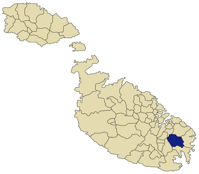
Iż-Żejtun , lying in the south-eastern part of Malta, covers the top of a hill, that dominates the nearby bays of Marsaxlokk, St Thomas and Marsascala, popular ports of call for all Mediterranean sailors since Phoenician times. They also provided convenient landing beaches for invaders.
Area: 5.4Km2 Residential: 1.5Km2 Rural: 3.2Km2 Industiral: 0.7Km2 Population density: 4 per 1000 sqr mtrs Housing units: 9 units per 1000 sqr mtrs
Iż-Żejtun (Citta’ Beland), meaning the fruit of the olive tree, covers the top of a hill, that dominates the nearby bays of Marsaxlokk, St Thomas and Marsascala, popular ports of call for all Mediterranean sailors since Phoenician times. They also provided convenient landing beaches for invaders. Hence the location was important as a lookout post for any approaching shipping. Archeological remains indicate that the area around Iż-Żejtun was already inhabited in Punic and Roman times, when the bay of Marsaxlokk was a very important port of call both for imports and exports.
Originally Iż-Żejtun (Terra Santa Caterina) covered the whole south east part of the island extending to the outskirts of the walls protecting Cottonera and including Ħaż-Żabbar, Marsascala and Marsaxlokk. The inhabitants of Iż-Żejtun proper till 1680 formed two separate communities known as Bisqallin (Lower Village) and Ħal Ġwann/Bisbut(Upper Village). Development during the eighteenth century and the construction of the new parish church according to the design of Lorenzo Gafa’,between the two communities formed the present centre and linked the community.
Iż-Żejtun , lying in the south-eastern part of Malta, covers the top of a hill, that dominates the nearby bays of Marsaxlokk, St Thomas and Marsascala, popular ports of call for all Mediterranean sailors since Phoenician times. They also provided convenient landing beaches for invaders.
Area: 5.4Km2 Residential: 1.5Km2 Rural: 3.2Km2 Industiral: 0.7Km2 Population density: 4 per 1000 sqr mtrs Housing units: 9 units per 1000 sqr mtrs